 No active warnings

About the Observatory
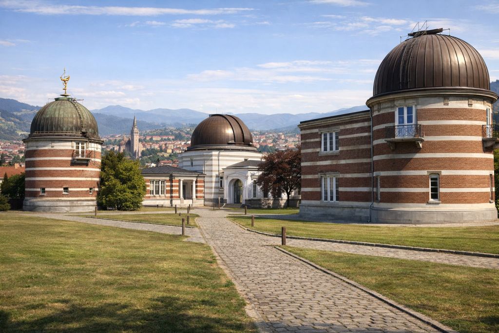
The Klow Royal Meteorological Observatory is the national weather service of the Kingdom of Syldavia. Established in 1876 by royal charter, the Observatory has for a century and a half monitored atmospheric conditions, issued weather forecasts, and studied the climate across Syldavian territory. Its headquarters are located in the capital, where the first instrumental observations were recorded in 1847, three decades before the charter.
Mission
The Observatory’s mission is to provide reliable meteorological and climatological information in service of public safety, agriculture, transport, and scientific research. It issues daily forecasts for the kingdom’s thirteen principal cities and disseminates warnings during hazardous weather events — storms, heavy snowfall across the Zymylpathian highlands, summer heatwaves in the continental plains.
The Observatory also serves as custodian of the national climatological archive, with continuous observational records dating back to 1847.
Observation network
The Observatory’s station network extends across the whole of the country, from the Adriatic coast at Dbrnouk and Vrajska to the mountain valleys of Vladivene and Sprodj, and the continental basins around Klow and Niedzdrow. Thirteen principal stations collect continuous measurements of temperature, precipitation, wind, humidity, and atmospheric pressure.
This network is supplemented by volunteer correspondents in rural municipalities, who submit daily rainfall and temperature readings. Syldavia has been a member of the World Meteorological Organization (WMO) since 1951, and all observations comply with current international standards and protocols.
Satellite observation
Building on the scientific tradition established at the Sprodj Atomic Research Centre — historic site of the lunar missions of the 1950s — the Observatory has undertaken a national space programme dedicated to Earth observation. The HVEGHI-1 meteorological satellite, launched from Sprodj in partnership with the Royal University of Klow and the Vladivene Technical Institute, acquires multispectral imagery from low polar orbit, measuring cloud cover, surface temperature, and atmospheric water vapour content.
The data collected feeds numerical forecast models in near-real time, significantly improving the accuracy of warnings for extreme weather events.

This website
This portal provides public access to current conditions, multi-day forecasts, and live precipitation radar across the whole of Syldavia. Numerical forecasts are powered in part by the Open-Meteo platform.
Station Directory
The following table lists all principal stations in the Observatory network, with their WMO identification codes, geographic coordinates, and station classification. All stations report in accordance with WMO Technical Regulations and transmit observations via the Global Telecommunication System.
| Station | WMO | Coordinates | Elevation | Type |
|---|---|---|---|---|
| Klow | 13742 | 44.00°N, 17.80°E | 520 m | |
| Dbrnouk | 13715 | 42.70°N, 18.40°E | 180 m | |
| Douma | 13720 | 43.10°N, 17.20°E | 120 m | |
| Kragoniedin | 13731 | 44.70°N, 19.30°E | 760 m | |
| Kropow | 13734 | 43.80°N, 17.30°E | 640 m | |
| Moltograd | 13748 | 44.20°N, 18.40°E | 340 m | |
| Niedzdrow | 13756 | 43.90°N, 19.20°E | 560 m | |
| Sprodj | 13770 | 46.00°N, 17.80°E | 2,000 m | |
| Staszow | 13778 | 42.90°N, 18.50°E | 620 m | |
| Vesnik | 13790 | 45.70°N, 16.30°E | 980 m | |
| Vladivene | 13795 | 46.05°N, 17.00°E | 1,250 m | |
| Vrajska | 13798 | 43.40°N, 16.55°E | 15 m | |
| Zlip | 13799 | 45.10°N, 17.50°E | 840 m |